 |
| Map of the Boise Driving Tour to go along with this guide. Find the map here. |
We're all still under the statewide Stay at Home order here in Idaho, but many of us are itching to get out and enjoy the beautiful spring weather we've been having. Luckily, outdoor recreation is still permissible and encouraged, as long as social distancing guidelines are followed.
Another great way to shake things up and enjoy the beauty of this time to year is to take a scenic drive around Boise. I put together a guide of some significant parts of Boise
Here is a map with directions between each stop on the driving tour: Boise Driving Tour Map
1. Start at the Idaho State Capitol Building in downtown Boise. Did you know it's the only capitol building in the U.S. that is heated with geothermal water? check out this online tour of the Capitol and this fact page on the Capitol.
2. Cruise through downtown and stretch your legs at Freak Alley Gallery, an alley-way of murals that is said to be the largest outdoor art gallery in the Northwest. This would be a great photo opportunity!
3. Venture on to Ann Morrison Park, a sprawling recreational area nestled by the beautiful Boise River. Park the car, and walk along a section of the Greenbelt to see if you can spot a Great Blue Heron in the river. This park is one site of Boise's Ribbon of Jewels, a group of parks that honor remarkable female civic leaders of Boise.
4. Head uphill to the Boise Depot, a Spanish-style structure that is owned by Boise Parks and Recreation Department and was built as a train depot for the Union Pacific Railroad. This gorgeous building is perched on the rim of Boise, is home to the beautiful Platt Gardens, and offers the best view of downtown Boise around.
5. As you make your way to Camel's Back Park, you'll drive through Hyde Park, a quaint part of Boise's Historic North End that has coffee shops, restaurants, and gift stores. Camel's Back Park has a beautiful vista from the top of the steep staircase you'll see from the Heron Street parking lot.
6. Optional (yet very scenic) Extension: drive up to Bogus Basin, the non-profit ski area operating under a Special Use Permit from the Boise National Forest. Along the way, you'll see sweeping views of the foothills and can use the vehicle turnouts to pull over and take your time to enjoy your drive. The roads are not currently being maintained due to Covid-19, so winter conditions may exist toward the top. Check here for more information.
If you're local, I hope you enjoy the Boise driving tour! What stops would you add to the list? If you're located elsewhere, come up with your own driving tour and share it with friends!
 |
| Idaho State Capitol from https://legislature.idaho.gov/capitol/ |
 |
| Freak Alley paintings from https://northend.org/freak-alley/ |
 |
| View of the Boise River from Ann Morrison Park |
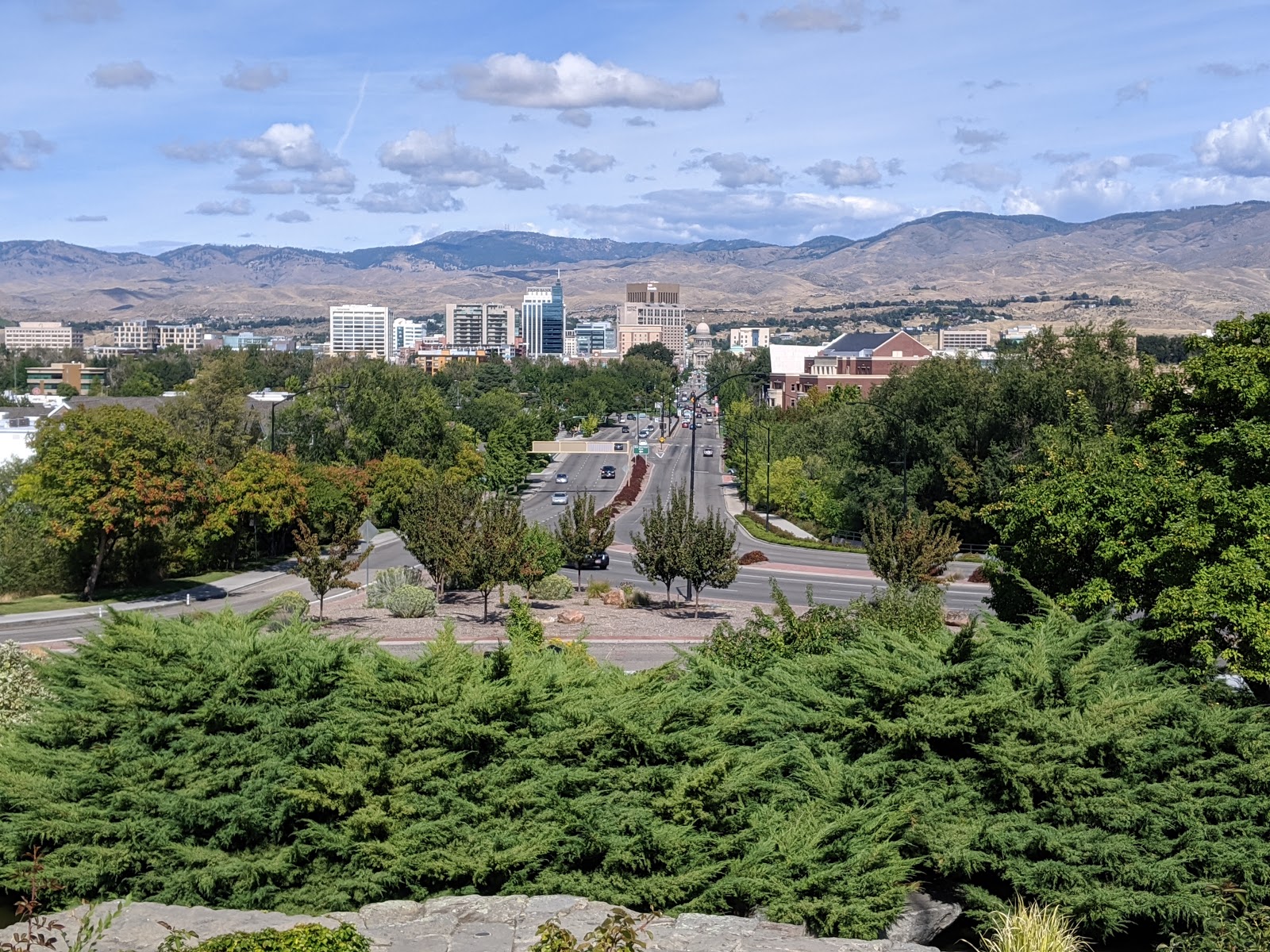 |
| View of Boise and the foothills from Boise Depot |
 |
| Boise Depot |
 |
| View from the top of the hill at Camel's Back Park |
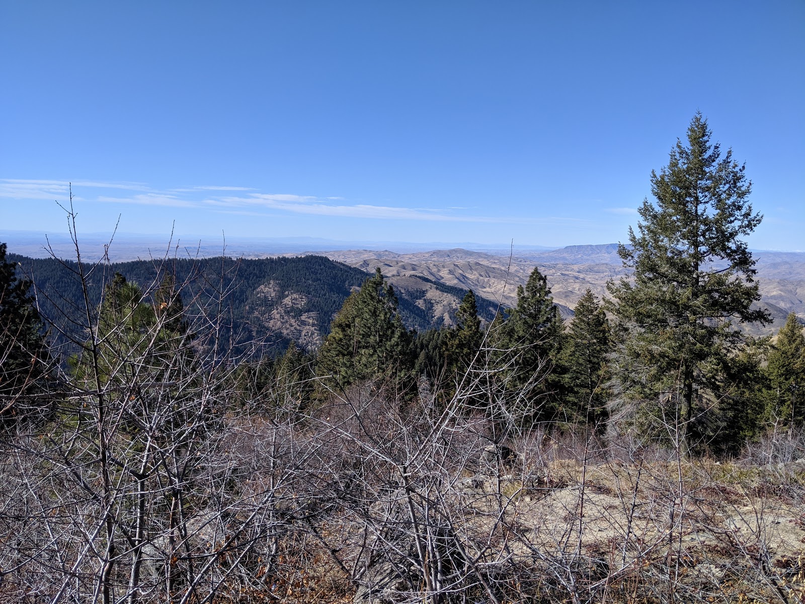 |
| Bogus Basin view |
I hope to do this tour! Great suggestion.
ReplyDelete